Next-Generation Mission Control From Earth-Bound to Orbit Intelligence
Quanmo transforms satellite operations with AI-powered infrastructure that reduces costs and complexity. From mission control and anomaly detection to intelligent copilots and data access, our solutions help you focus on mission success instead of operational overhead.

Mission Control as a Service
Setting up mission ops infrastructure typically takes months of engineering time and significant capital investment. Quanmo's plug-and-play mission control platform gives you a complete solution within days of integration, handling everything from telemetry processing to command verification to anomaly detection. Our platform includes real-time monitoring dashboards, scheduling systems, and customizable alert mechanisms. Built with modern API-first architecture, it integrates seamlessly with your existing ground station networks and scales economically from a single satellite to entire constellations.
- Deploy in 4 weeks vs. 6+ months for custom solutions
- Reduce infrastructure costs by up to 70%
- Operate with 50% lower ongoing expenses
Co-pilot for Satellite Operations
Satellite operations traditionally require continuous human decision-making for everything from pass planning to anomaly response. Quanmo's AI Co-pilot transforms this paradigm by providing intelligent, autonomous assistance that augments your team's capabilities. Our system maintains continuous system awareness, modeling complex relationships between mission objectives, satellite health, and operational constraints. It autonomously handles routine tasks while providing decision support for complex situations, with all information contextualized to current operational priorities.
- Manage 5x more satellites with the same team
- Respond to anomalies 15x faster
- Reduce operator workload by up to 90%


Autonomous Co-ordinated Collection Planning
Traditional satellite tasking relies on fixed schedules and manual prioritization that can't adapt to changing conditions or opportunities. Nexus transforms tasking through an intelligent system that continuously optimizes collection plans based on mission priorities, satellite capabilities, and real-time conditions. Our AI-driven platform evaluates thousands of potential collection opportunities against current priorities, weather conditions, and resource constraints to create the optimal tasking schedule. It can autonomously adjust plans when new high-priority targets emerge or when conditions change, ensuring you always capture the most valuable data possible.
- Increase valuable collections by up to 35%
- Autonomously retask for fleeting opportunities
- Optimize across entire constellations, not just individual satellites
Onboard Data Quality Assessment
Satellite operators waste valuable downlink bandwidth on corrupted or unusable data, compromising mission efficiency and increasing operational costs. Onboard Data Quality Assessment provides autonomous validation of both SAR and optical payload data in real-time before downlink, ensuring you only transmit high-quality data that meets your mission requirements. By applying specialized algorithms for optical imagery and SAR data, our solution filters out compromised data onboard. This maximizes downlink efficiency, reduces storage requirements, and increases effective mission productivity without hardware changes.
- Reduce downlinked data volume by up to 40%
- Eliminate transmission of unusable imagery
- Extend mission life through optimized resource usage

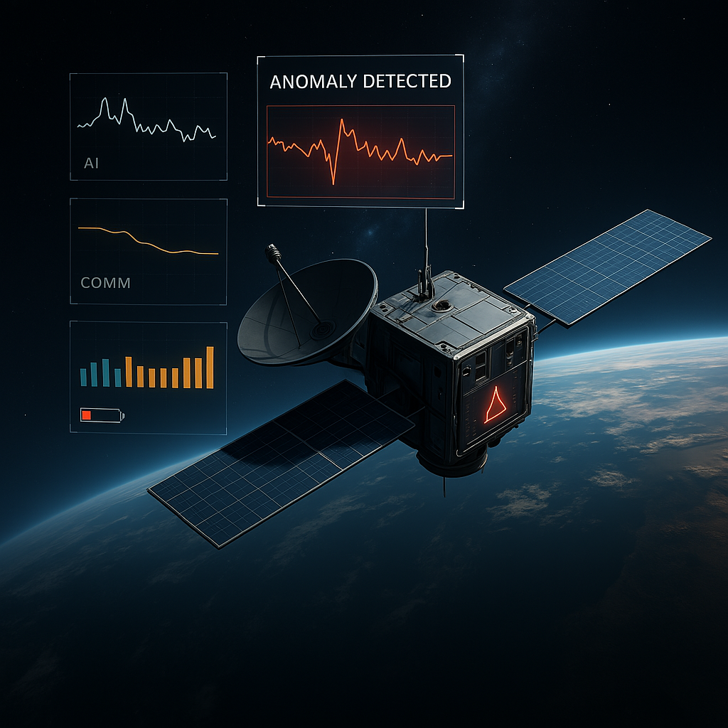
Pulse: PagerDuty for Satellites
Traditional satellite monitoring relies on threshold-based alerts that often catch problems too late or generate excessive false positives. Pulse revolutionizes health monitoring by using advanced machine learning to detect subtle pattern changes across thousands of telemetry points simultaneously. The system establishes dynamic baselines for normal operations, accounting for factors like orbital position and operational state. When anomalous behavior emerges, Pulse traverses telemetry dependency graphs to identify root causes rather than symptoms, delivering actionable alerts with specific remediation recommendations.
- 12-hour early warning on up to 94% of anomalies
- Fewer false positive alerts
- Automatic root cause identification across subsystems
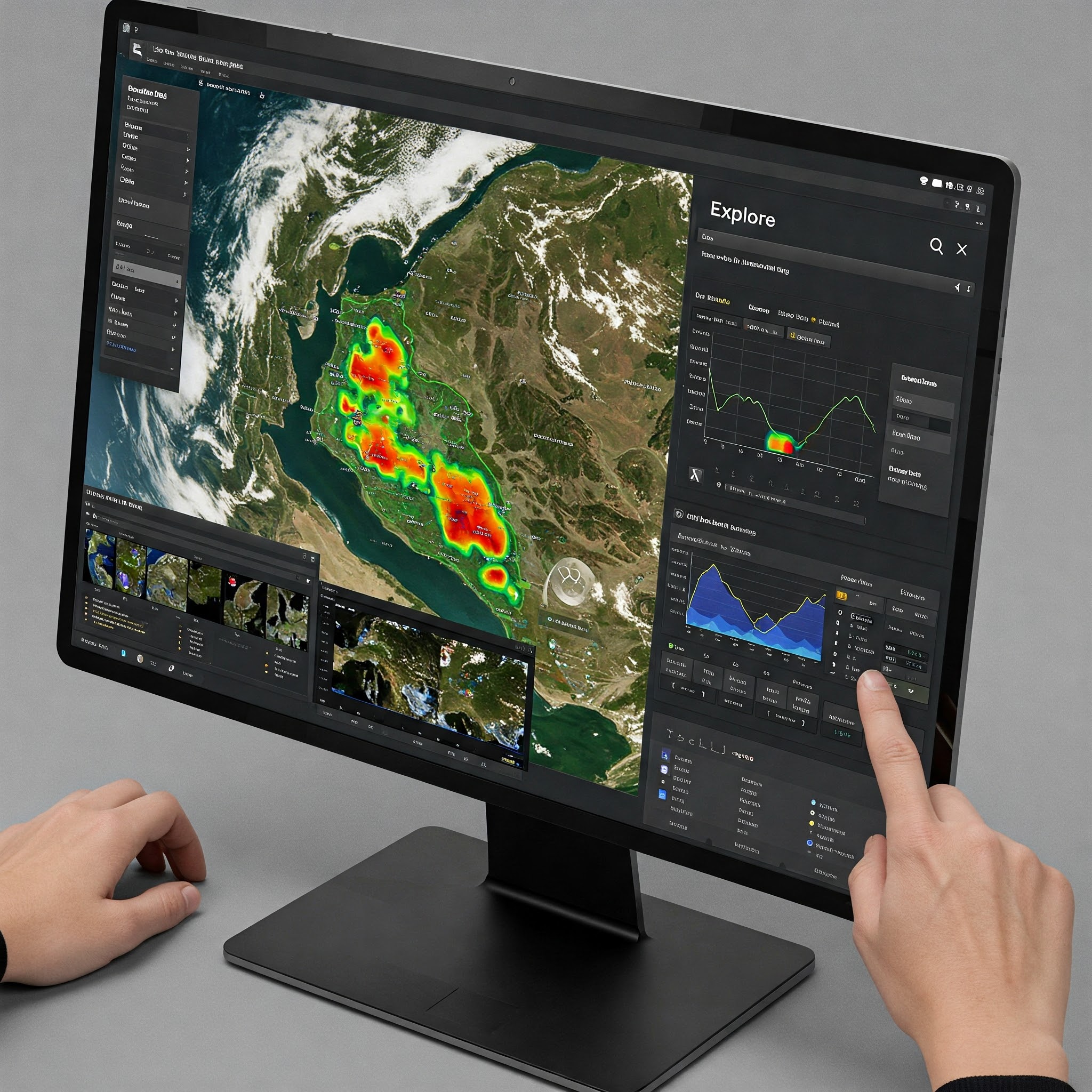
Explore: Public & Open Satellite Data
Earth observation data is abundant but fragmented across dozens of platforms with inconsistent interfaces, formats, and quality. Explore solves this problem by providing unified access to a curated catalog of public satellite imagery from multiple sources and sensor types. Our platform consolidates optical, radar, and multispectral imagery into a searchable database with standardized metadata and consistent quality indicators. Advanced geographic and parameter-based filtering lets you quickly find exactly what you need, with instant preview capabilities to assess data quality before downloading.
- Seamless access to open & publicly available imagery
- 15+ public satellite sources through one interface
- Eliminate 80% of data preparation work